Region · Valencian Community

Region

The land

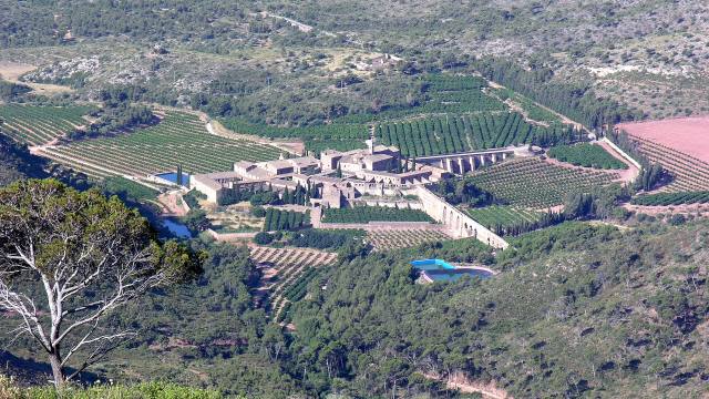
The landscape falls into three zones: a plain to the south, along the Túria river, with wetlands and irrigated farmland; a central band of low, drier hills; and a mountainous north that forms part of the Sierra Calderona.

Identity

The region combines traditional farming towns, large residential areas and industrial estates. Its hallmarks are music —with Llíria as a UNESCO Creative City of Music—, Iberian and Roman heritage and two natural parks: the Sierra Calderona and the Túria Natural Park.
Where is Camp de Túria

The municipalities are between about 14 km (San Antonio de Benagéber) and about 50 km (Domeño) from València.

History of Camp de Túria

From Edeta to Mura: the Iberian and Roman past of Llíria you can visit

How to get to Camp de Túria from Valencia

Metrovalencia in Camp de Túria: a practical guide to lines, stations and tickets

Economy and activity of Camp de Túria

What to see and do in Camp de Túria

Municipalities

Municipality Population Area
Benaguasil 12,668 inh. 25.4 km²
Benissanó 2,449 inh. 2.3 km²
Bétera 28,560 inh. 75.7 km²
Casinos 3,153 inh. 41.5 km²
Domeño 723 inh. 68.8 km²
Gátova 452 inh. 30.4 km²
L'Eliana 19,839 inh. 8.8 km²
La Pobla de Vallbona 27,471 inh. 33.1 km²
Llíria 25,333 inh. 227.9 km²
Loriguilla 2,188 inh. 72.4 km²
Marines 1,967 inh. 35.7 km²
Náquera 8,556 inh. 38.7 km²
Olocau 2,534 inh. 37.4 km²
Riba-roja de Túria 24,616 inh. 57.5 km²
San Antonio de Benagéber 11,192 inh. 8.7 km²
Serra 3,767 inh. 57.3 km²
Vilamarxant 11,403 inh. 71.1 km²
Region total 186,871 inh. (INE 2025)